Projects & Partner Organisations!
Here’s the ever-growing list of the projects and organisations which have utilised CoMet’s capabilities!
🗸 QA4EO
📋 Overview: QA4EO is a Quality Assurance framework for Earth Observation (EO) data, providing guidance and best practices across the EO community.
🔗 URL: QA4EO Website
☄️ Involvement: The CoMet toolkit received funding from QA4EO for its development and provides the tools for the practical implementation of some of the QA4EO steps to an uncertainty budget.

🗸 HYPERNETS
📋 Overview: HYPERNETS developed an automated network of hyperspectral radiometers for validating surface reflectance of water and land for satellite missions.
🔗 URL: HYPERNETS Website
☄️ Involvement: The CoMet toolkit is used within the HYPERNETS_processor to propagate uncertainties from lab calibration through each of its products. See also this case study page.

🗸 CHIME L2
📋 Overview: The CHIME L2 project performs atmospheric correction for the Copernicus Hyperspectral Imaging Mission for the Environment (CHIME).
☄️ Involvement: CoMet is used for the uncertainty propagation through the atmospheric correction algorithms.
🗸 FLEX validation
📋 Overview: FLEX validation supports the calibration and validation of ESA’s Fluorescence Explorer mission using ground-based and airborne measurements.
☄️ Involvement: The CoMet toolkit is used to ensure the validation results are accompanied by uncertainties, and thus can be reliably interpreted.

🗸 LIME
📋 Overview: LIME is the Lunar Irradiance Model of the European Space Agency (ESA), which aims to determine an improved lunar irradiance model with sub-2% radiometric uncertainties.
🔗 URL: LIME Website
☄️ Involvement: These uncertainties are propagated through the LIME toolbox using CoMet.
🗸 Met4EO
📋 Overview: Met4EO aims to develop, apply and extend a metrological approach to the uncertainty analysis and comparison of satellite data products.
☄️ Involvement: The CoMet toolkit will be used in a range of its case studies.
🗸 TACOS
📋 Overview: The TRUTHS mission Accompanying Consolidation Towards Operations Study (TACOS) performs scientific studies in preparation of the TRUTHS mission.
☄️ Involvement: The CoMet toolkit is used for uncertainty propagation in various parts.

🗸 FRM4SOC
📋 Overview: FRM4SOC sets out to define above-water ocean colour radiometry best practice for measurement and uncertainty propagation, for two radiometers in common usage, being implementing into an open source community processor.
🔗 URL: FRM4SOC Website
☄️ Involvement: CoMet has been used heavily to propagate uncertainties through a complicated measurement system and provide uncertainty outputs for L1 and L2 products.

🗸 RPV4PICS
📋 Overview: RPV4PICS advances reflectance product validation for satellite data using improved BRDF and aerosol modelling over Pseudo Invariant Calibration Sites (PICS).
☄️ Involvement: Uncertainties were propagated using CoMet.

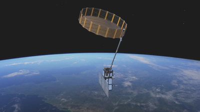
🗸 MACRAD
📋 Overview: - The Metrological Analysis of CIMR Radiometry (MACRAD) study.
☄️ Involvement: Uses CoMet to propagate uncertainties for the Copernicus Imaging Microwave Radiometer (CIMR) mission.
🗸 FDR4ATMOS
📋 Overview: - FDR4ATMOS develops methodologies for full‐disclosure radiometry in atmospheric remote sensing to support climate monitoring.
🗸 DTE-S2GOS
📋 Overview: The Digital Twin Earth Synthetic Scene Generator and Observation Simulator (DTE-S2GOS) project focuses on developing a new pre-operational service to be implemented as a component of the ESA DestinE Platform.
🔗 URL: S2GOS Website
☄️ Involvement: Validation of this service needs a metrological approach, which is implemented using CoMet.
🗸 DEFLOX
📋 Overview: DEFLOX is a project supporting the development of the FloX system for Solar induced Chlorophyll Fluorescence observation.
☄️ Involvement: The CoMet Toolkit is being used to develop uncertainty propagation through the FLOX processing chain.
🗸 FRM4FLUO
📋 Overview: - FRM4FLUO establishes standards for the calibration and validation of satellite-derived fluorescence measurements of vegetation.
🗸 GRUAN
📋 Overview: Global Climate Observing System (GCOS) ensures access to long-term climate observations. Within GCOS, the GCOS Reference Upper-Air Network (GRUAN) plays a key role by providing reference-quality atmospheric balloon data.
🔗 URL: GRUAN Website
☄️ Involvement: A case study where the CoMet Toolkit has been successfully implemented with GRUAN data to acquire covariance information of GRUAN data. Read more on the case study page.

🗸 St3TART-FO
📋 Overview: The St3TART-FO project is aimed at providing an operational framework for Fiducial Reference Measurements (FRM) in support of the validation activities of the Sentinel-3 (S3) radar altimeter over land surfaces of interest, including inland water bodies (lakes, reservoirs, rivers including estuarian areas), as well as sea ice and land ice areas (ice caps, mountain glaciers, etc.).
🔗 URL: St3TART Website
☄️ Involvement: CoMet has been used to implement uncertainty propagation within the St3TART-FO project.
